Tile Design Online Features
Tile Design Online enables the design of fully functional water flow, both above and below the surface, through easily created visualizations of terrain in contour maps, watershed maps, and satellite imagery. Tile Design Online is a dynamic design tool for in-office use: The entire design is live throughout the development process. Every line and vertex drawn is movable, and interdependencies are included. If one breakline is moved, all joined mains and lateral move along. As with any design software, accuracy is relative to the parameters, and Tile Design Online includes more parameters to manipulate—as well as automatic detection of parameter violations.
Simple click-and-drag controls encourage experimentation to find the best possible water flow either through surface shaping and drains or through a tile system. Save your designs for access later and pick up where you left off. Right-click any drawn line to fine-tune its properties.
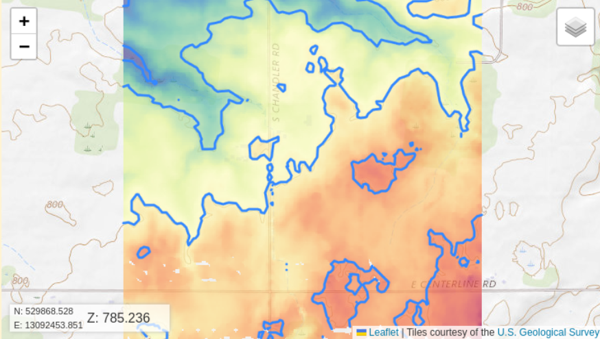 With Tile Design Online, you can experiment with optimal tile systems without moving a foot of dirt. A digital elevation model is created based on GPS sampling of a field. A contour map is automatically created, based on the digital elevation model. The user can specify the desired difference in elevation between contour lines; the intervals between contour lines can be adjusted to be appropriate to the irregularity of the terrain. The contour map, with color-coded elevations, provides a clear visual guide to the natural movement of water and the best placement of tiles.
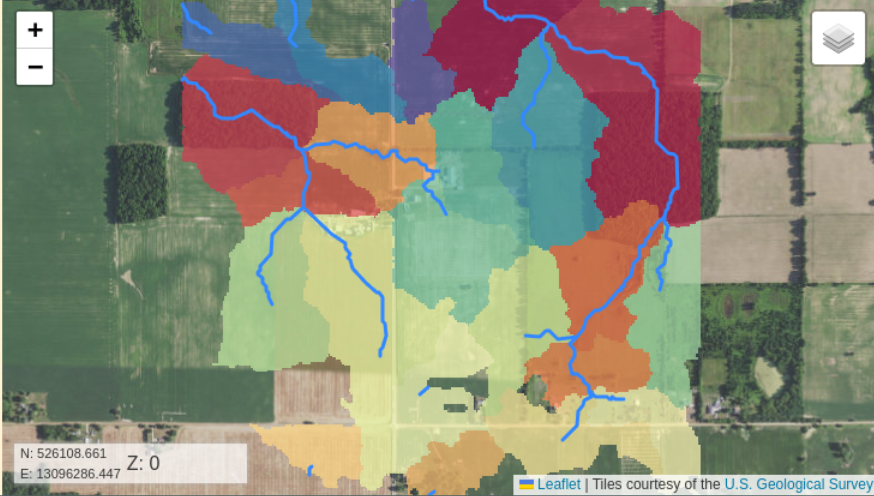 Watersheds are calculated based on the digital elevation model created with GPS sampling of field elevations. The likely locations of streams and ponds can be generated. The user can set an accumulation threshold; this threshold is the amount of water needed to define a watershed. Adjusting this setting will delineate finer or more coarse watersheds. The visual representation of watersheds informs the user as to the best places to lay tile.
 Tile Design Online supports the design of precise water management tiling systems. By overlaying a tile design and watershed outlets on a digital elevation model, it’s clear where water will naturally collect or flow. This is especially helpful in integrating water movement in a field or property with existing county drains. The digital elevation model is constructed using GPS data. The user can specify inventories of tile sizes; tiles are automatically sized for lowest cost based on industry standards.
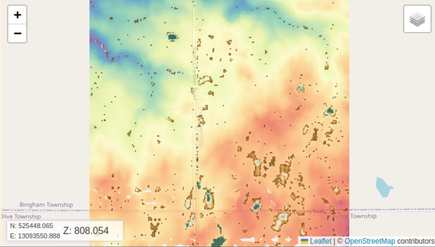
 With satellite imagery turned on, the user can augment the tile design, digital elevation model, watershed map, and contour map. This capability provides additional visual data to check for trees, streams, landmarks, or other elements that could influence the success of the design or its implementation. The satellite imagery can be more or less transparent, as needed, and labels can be added to clearly communicate the plan.
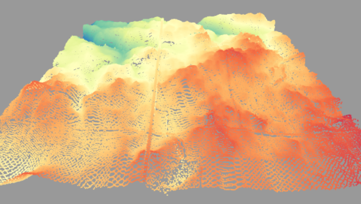
A 3D visualization of the surface points can be generated to give a three-dimensional view of the terrain.
Software Function
Tile Design Online imports and displays data from various file types, including topographic files (XYZ, NEZ), point shapefiles (SHP), Lidar files (LAS, LAZ), Apex (CSV), and GeoTIFF (TIF, TIFF). Thinning options support the import of large data sets in Lidar files. Coordinate systems are identified using standard EPSG numbers. Data is accepted in latitude/longitude, UTM, and State Plane coordinate systems using meters and feet.
![]() Online tutorials are available that demonstrate screen navigation, adding survey data layers, managing inventory and parameter groups, drawing tile layouts, designing successful tile systems, and sharing and exporting system designs. Training is available through participating dealers.
Online tutorials are available that demonstrate screen navigation, adding survey data layers, managing inventory and parameter groups, drawing tile layouts, designing successful tile systems, and sharing and exporting system designs. Training is available through participating dealers.